Category:Storrington and Sullington
Jump to navigation
Jump to search
English: Storrington and Sullington is a civil parish in the Horsham district, in the county of West Sussex, England.
civil parish in West Sussex, England, UK  | |||||
| Upload media | |||||
| Instance of | |||||
|---|---|---|---|---|---|
| Location | Horsham, West Sussex, South East England, England | ||||
| Area |
| ||||
| official website | |||||
 | |||||
Subcategories
This category has the following 3 subcategories, out of 3 total.
Media in category "Storrington and Sullington"
The following 200 files are in this category, out of 471 total.
(previous page) (next page)-

-

-
 A conversion at Hurston Place Farm - geograph.org.uk - 2471738.jpg 640 × 480; 126 KB
-
 A fortunate lie - geograph.org.uk - 2471655.jpg 640 × 480; 85 KB
-
 A particularly sheltered Coldharbour - geograph.org.uk - 2282861.jpg 640 × 480; 131 KB
-
 A rolling field of wheat - geograph.org.uk - 1924255.jpg 640 × 428; 84 KB
-
 A splash of colour on Chantry Hill - geograph.org.uk - 2514160.jpg 768 × 1,024; 209 KB
-
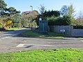
 A283 entrance to Storrington - geograph.org.uk - 4888372.jpg 640 × 480; 104 KB
-
 A283 in Northpark Wood - geograph.org.uk - 4633769.jpg 1,600 × 1,600; 1.99 MB
-
 A283 south of Bog Common - geograph.org.uk - 3984602.jpg 3,795 × 2,251; 1.65 MB
-
 A283, Storrington - geograph.org.uk - 5566315.jpg 640 × 378; 60 KB
-
 Access land above Chantry Lane - geograph.org.uk - 2520644.jpg 1,024 × 768; 149 KB
-
 Access path to Faithfull Crescent - geograph.org.uk - 4626518.jpg 800 × 600; 109 KB
-
 Access to Kithurst Hill Car Park - geograph.org.uk - 1239980.jpg 480 × 640; 79 KB
-
 Across the grain - geograph.org.uk - 2405918.jpg 1,600 × 1,198; 250 KB
-
 Air Quality Monitoring Station - geograph.org.uk - 3225151.jpg 4,000 × 3,000; 4.14 MB
-
 An old, but sturdy wall, Clay Lane, Cootham - geograph.org.uk - 4631479.jpg 1,600 × 1,200; 1.41 MB
-
 Angmering Park Estate - geograph.org.uk - 2426771.jpg 4,320 × 3,240; 6.5 MB
-
 Approaching Chantry Post - geograph.org.uk - 5927629.jpg 1,600 × 1,085; 468 KB
-
 Arun District , Storrington ^ West Chiltington Common - geograph.org.uk - 3106932.jpg 3,216 × 2,136; 3.18 MB
-
 Ascending Barnsfarm Hill - geograph.org.uk - 2426957.jpg 4,320 × 3,240; 6.18 MB
-
 At the base of the downs - geograph.org.uk - 2001650.jpg 640 × 427; 234 KB
-
 B2139, Amberley Rd - geograph.org.uk - 5569420.jpg 640 × 426; 80 KB
-
 B2139, Amberley Rd - geograph.org.uk - 5569828.jpg 640 × 479; 101 KB
-
 Bales near Cobden Farm - geograph.org.uk - 3657966.jpg 640 × 457; 42 KB
-
 Barclays in Old Mill Square - geograph.org.uk - 2625114.jpg 640 × 480; 86 KB
-
 Barn being converted, Sullington - geograph.org.uk - 5110149.jpg 640 × 480; 85 KB
-
 Barn by South Downs Way - geograph.org.uk - 5110214.jpg 640 × 480; 84 KB
-
 Barn conversion, Clay Lane, Cootham - geograph.org.uk - 4631475.jpg 1,600 × 1,200; 1.31 MB
-
 Barn on South Downs Way - geograph.org.uk - 1983089.jpg 800 × 600; 80 KB
-
 Barn with bales, Sullington - geograph.org.uk - 5110161.jpg 640 × 480; 86 KB
-

-
 Barnsfarm Hill - geograph.org.uk - 3658019.jpg 640 × 480; 77 KB
-
 Bench Mark on Trig Point on Kithurst Hill - geograph.org.uk - 2342823.jpg 4,000 × 3,000; 3.29 MB
-
 Bend in Clay Lane - geograph.org.uk - 2340940.jpg 4,000 × 3,000; 3.7 MB
-
 Beside Sullington Hill - geograph.org.uk - 5927617.jpg 1,600 × 1,110; 515 KB
-
 Boardwalk on footpath by field edge - geograph.org.uk - 4626459.jpg 800 × 600; 213 KB
-
 Bollards, Water Lane - geograph.org.uk - 3568901.jpg 4,000 × 3,000; 4.23 MB
-
 Boots Pharmacy, Storrington - geograph.org.uk - 5566306.jpg 640 × 557; 82 KB
-
 Bridge over River Stor, Hurston Lane - geograph.org.uk - 4042498.jpg 640 × 427; 113 KB
-

-
 Bridge over stream on what was once Fryern Hall land - geograph.org.uk - 2345971.jpg 4,000 × 3,000; 3.34 MB
-
 Bridlegate near Waterfall Cottage - geograph.org.uk - 2514046.jpg 768 × 1,024; 303 KB
-
 Bridlegate on top of Chantry Hill - geograph.org.uk - 2514313.jpg 1,024 × 768; 254 KB
-

-
 Bridleway adjacent to the South Downs Way - geograph.org.uk - 2342754.jpg 4,000 × 3,000; 3.77 MB
-
-
 Bridleway arrives at Chantry Lane - geograph.org.uk - 2519398.jpg 1,024 × 768; 234 KB
-
 Bridleway climbing northern escarpment of South Downs - geograph.org.uk - 2342600.jpg 4,000 × 3,000; 3.69 MB
-
 Bridleway climbing northern slope of South Downs - geograph.org.uk - 2342577.jpg 4,000 × 3,000; 3.51 MB
-
 Bridleway crosses gallops near Barns Farm (1) - geograph.org.uk - 2515397.jpg 768 × 1,024; 236 KB
-
 Bridleway crosses gallops near Barns Farm (2) - geograph.org.uk - 2515402.jpg 1,024 × 768; 271 KB
-

-

-
 Bridleway crossing Golf Course - geograph.org.uk - 4946328.jpg 4,608 × 3,456; 5.32 MB
-
 Bridleway crossing the South Downs Way - geograph.org.uk - 3114201.jpg 1,600 × 1,064; 415 KB
-
 Bridleway down Kithurst Hill - geograph.org.uk - 2282817.jpg 640 × 480; 183 KB
-
 Bridleway from Paygate to the South Downs - geograph.org.uk - 2341073.jpg 4,000 × 3,000; 3.54 MB
-

-
 Bridleway junction near the top of Chantry Hill - geograph.org.uk - 2514306.jpg 1,024 × 768; 190 KB
-
 Bridleway junction near the top of Kithurst Hill - geograph.org.uk - 2342763.jpg 4,000 × 3,000; 3.74 MB
-
 Bridleway junction west of Barns Farm - geograph.org.uk - 2515395.jpg 1,024 × 768; 222 KB
-
 Bridleway leaves Chantry Lane - geograph.org.uk - 2514316.jpg 1,024 × 768; 168 KB
-
 Bridleway on Kithurst Hill - geograph.org.uk - 2426752.jpg 4,320 × 3,240; 6.18 MB
-
 Bridleway reaches Greenhurst Lane - geograph.org.uk - 4636214.jpg 800 × 600; 202 KB
-
 Bridleway signpost above Storrington - geograph.org.uk - 4635798.jpg 800 × 600; 154 KB
-
 Bridleway south - geograph.org.uk - 2454455.jpg 4,000 × 3,000; 2.83 MB
-
 Bridleway south to Lee Farm - geograph.org.uk - 2520533.jpg 1,024 × 768; 141 KB
-
 Bridleway through Barns Farm - geograph.org.uk - 2515387.jpg 1,024 × 768; 232 KB
-
 Bridleway through West Sussex Golf Course - geograph.org.uk - 246049.jpg 640 × 479; 140 KB
-
 Bridleway to Kithurst Hill Car Park - geograph.org.uk - 3639100.jpg 480 × 640; 81 KB
-
 Bridleway to Lee Farm - geograph.org.uk - 3584806.jpg 640 × 480; 69 KB
-
 Bridleway turns west on the South Downs - geograph.org.uk - 2519534.jpg 1,024 × 768; 198 KB
-
 Buildings at Cobden Farm - geograph.org.uk - 1983105.jpg 800 × 600; 89 KB
-
 Bus stop, West Chiltington Road - geograph.org.uk - 3575651.jpg 4,000 × 3,000; 4.12 MB
-
 Bush by footpath on Chantry Hill - geograph.org.uk - 2514149.jpg 1,024 × 768; 204 KB
-
 Bush Field - geograph.org.uk - 3639086.jpg 640 × 480; 60 KB
-
 Byway beside Highden Beeches - geograph.org.uk - 1983099.jpg 600 × 800; 165 KB
-
 Byway leaves South Downs Way near Chantry Post - geograph.org.uk - 2514348.jpg 1,024 × 768; 162 KB
-
 Cambered turn on bridleway near the top of Kithurst Hill - geograph.org.uk - 2342625.jpg 4,000 × 3,000; 3.52 MB
-
 Car park by the South Downs Way - geograph.org.uk - 2342654.jpg 4,000 × 3,000; 3.54 MB
-
 Car Park exit - geograph.org.uk - 3224392.jpg 4,000 × 3,000; 2.94 MB
-
 Cattle grazing in the valley - geograph.org.uk - 2474186.jpg 640 × 480; 106 KB
-
 Chantry Hill - geograph.org.uk - 1003093.jpg 640 × 479; 79 KB
-
 Chantry Hill - geograph.org.uk - 6130447.jpg 1,024 × 683; 237 KB
-
 Chantry Lane - geograph.org.uk - 6130438.jpg 1,024 × 683; 310 KB
-
 Chantry Post - geograph.org.uk - 1982932.jpg 600 × 800; 65 KB
-
 Chantry Post - geograph.org.uk - 3114174.jpg 1,064 × 1,600; 401 KB
-
 Chantry Post at Sunrise - geograph.org.uk - 3655766.jpg 640 × 480; 56 KB
-
 Chantry Post Car Park - geograph.org.uk - 3631381.jpg 640 × 480; 80 KB
-

-
 Churchill Tank at Kithurst Hill, West Sussex - geograph.org.uk - 6087308.jpg 1,024 × 683; 287 KB
-
 Churchill Tank at Kithurst Hill, West Sussex - geograph.org.uk - 6087311.jpg 1,024 × 683; 294 KB
-
 Churchill Tank at Kithurst Hill, West Sussex - geograph.org.uk - 6087312.jpg 1,024 × 683; 255 KB
-
 Churchill Tank at Kithurst Hill, West Sussex - geograph.org.uk - 6087315.jpg 1,024 × 683; 254 KB
-
 Churchill Tank at Kithurst Hill, West Sussex - geograph.org.uk - 6087321.jpg 1,024 × 683; 287 KB
-
 Churchill Tank at Kithurst Hill, West Sussex - geograph.org.uk - 6087330.jpg 1,024 × 683; 314 KB
-
 Clay Lane leading north to Cootham - geograph.org.uk - 4631470.jpg 1,600 × 1,600; 1.57 MB
-
 Clay Lane south to the South Downs - geograph.org.uk - 2340920.jpg 4,000 × 3,000; 3.16 MB
-
 Clayton Kennels - geograph.org.uk - 3455059.jpg 640 × 480; 83 KB
-
 Clayton Mead - geograph.org.uk - 3455035.jpg 640 × 480; 109 KB
-
 Climbing Barnsfarm Hill - geograph.org.uk - 1003209.jpg 640 × 374; 42 KB
-
 Climbing the west side of Barnsfarm Hill - geograph.org.uk - 4594154.jpg 1,142 × 857; 354 KB
-
 Closely knit wool - geograph.org.uk - 2339139.jpg 4,000 × 3,000; 3.5 MB
-
 Clouds above the downs - geograph.org.uk - 2519572.jpg 1,024 × 768; 75 KB
-
 Cobden Farm - geograph.org.uk - 3657992.jpg 640 × 480; 46 KB
-
 Cock Hill Field - geograph.org.uk - 3631352.jpg 640 × 453; 75 KB
-
 Confused notice by Highden Beeches - geograph.org.uk - 1983113.jpg 800 × 600; 124 KB
-
 Coombe Below Kithurst Hill - geograph.org.uk - 3584823.jpg 640 × 375; 57 KB
-
 Cootham Village Hall - geograph.org.uk - 2340784.jpg 4,000 × 3,000; 3.12 MB
-

-
 Cowslips on Chantry Hill - geograph.org.uk - 3736288.jpg 2,700 × 1,800; 232 KB
-
 Crown Inn, Cootham - geograph.org.uk - 4133731.jpg 1,600 × 1,483; 542 KB
-
 Damaged Stile - geograph.org.uk - 3573726.jpg 4,000 × 3,000; 5 MB
-
 Dark Monochrome Tree (192870739).jpeg 1,365 × 2,048; 556 KB
-
 Descending off Barnsfarm Hill - geograph.org.uk - 2426990.jpg 4,320 × 3,240; 5.37 MB
-
 Dew Pond, Kithurst Hill - geograph.org.uk - 3639041.jpg 640 × 480; 72 KB
-
 Dilapidated stile - geograph.org.uk - 3573481.jpg 4,000 × 3,000; 4.37 MB
-
 Dip on the downs - geograph.org.uk - 2519557.jpg 768 × 1,024; 212 KB
-

-
 Disused pit between Kithurst Hill and Chantry Hill - geograph.org.uk - 2343069.jpg 4,000 × 3,000; 3.5 MB
-
 Douglas Lodge (geograph 6797984).jpg 1,600 × 1,020; 677 KB
-
 Douglas Lodge - geograph.org.uk - 3973309.jpg 3,843 × 2,868; 2.08 MB
-
 Douglas's Lodge - geograph.org.uk - 2340893.jpg 4,000 × 3,000; 3.41 MB
-
 Downhill towards the River Stor - geograph.org.uk - 1670133.jpg 1,600 × 1,200; 706 KB
-
 Downland west of Cobden Farm - geograph.org.uk - 1985154.jpg 800 × 600; 67 KB
-
 Downs south of Sullington Hill - geograph.org.uk - 6130456.jpg 1,024 × 683; 250 KB
-
 Dry Valley near Blackpatch Hill - geograph.org.uk - 1330136.jpg 640 × 480; 63 KB
-
 Entering Storrington, A283 - geograph.org.uk - 5566305.jpg 640 × 426; 100 KB
-
 Entrance to Kithurst Hill Car Park - geograph.org.uk - 3224389.jpg 4,000 × 3,000; 3.59 MB
-
 Entrance to Parham House and Gardens - geograph.org.uk - 2340799.jpg 4,000 × 3,000; 3.32 MB
-
 Entrance to St Joseph's Hall - geograph.org.uk - 2345635.jpg 4,000 × 3,000; 3.26 MB
-
 Entrance to The Old Rectory - geograph.org.uk - 3223725.jpg 1,600 × 1,200; 864 KB
-
 Fallen tree by course of old Roman Road - geograph.org.uk - 1671204.jpg 1,600 × 1,200; 522 KB
-

-
 Farm track towards Highden Beeches - geograph.org.uk - 2514427.jpg 1,024 × 768; 177 KB
-
 Farm Track, Angmering Park Estate - geograph.org.uk - 3639074.jpg 640 × 480; 86 KB
-
 Farming notice on Barnsfarm Hill - geograph.org.uk - 2514463.jpg 1,600 × 1,200; 402 KB
-
 Farmland below Chantry Post - geograph.org.uk - 6130452.jpg 1,024 × 683; 226 KB
-
 Farmyard corner, Sullington - geograph.org.uk - 5110138.jpg 640 × 480; 126 KB
-
 February lamb - geograph.org.uk - 2282783.jpg 640 × 480; 126 KB
-
 Fence boundary for Fryern Hall Farm - geograph.org.uk - 2346002.jpg 3,893 × 2,892; 2.66 MB
-
 Fences with vegetation - geograph.org.uk - 4516032.jpg 4,608 × 3,456; 6.07 MB
-

-

-

-

-
 Field edge beside Chantry Lane - geograph.org.uk - 6130431.jpg 1,024 × 683; 300 KB
-
 Field gate on footpath up Chantry Hill - geograph.org.uk - 2514128.jpg 1,024 × 768; 282 KB
-

-
 Field with poppies and trough on the South Downs - geograph.org.uk - 2519546.jpg 1,024 × 768; 253 KB
-
 Field, Kithurst Hill - geograph.org.uk - 3631378.jpg 640 × 480; 85 KB
-
 Fields at Sullington - geograph.org.uk - 4489695.jpg 640 × 480; 107 KB
-
 Fields near Storrington - geograph.org.uk - 5376906.jpg 640 × 480; 86 KB
-
 Fingerpost and stile - geograph.org.uk - 3573533.jpg 4,000 × 3,000; 4.59 MB
-
 Fingerpost with holly - geograph.org.uk - 4516040.jpg 4,608 × 3,456; 6.85 MB
-
 Flowers in a field - geograph.org.uk - 5951071.jpg 640 × 480; 253 KB
-
 Footpath approaching Greenhurst Lane - geograph.org.uk - 3584116.jpg 4,000 × 3,000; 5.5 MB
-
 Footpath at field corner by The Chantry - geograph.org.uk - 2514098.jpg 1,024 × 768; 297 KB
-
 Footpath between fences - geograph.org.uk - 4514444.jpg 4,608 × 3,456; 5.62 MB
-
 Footpath between the Chantry and Grey Friars Farm - geograph.org.uk - 2343076.jpg 4,000 × 3,000; 3.48 MB
-

-
 Footpath Crosses Fields from Kithurst Car Park - geograph.org.uk - 5349077.jpg 4,608 × 3,456; 6.13 MB
-
 Footpath FP2631 - geograph.org.uk - 3225117.jpg 2,807 × 2,000; 1.52 MB
-
 Footpath FP2654 - geograph.org.uk - 3225205.jpg 4,000 × 3,000; 2.51 MB
-
 Footpath FP2664 - geograph.org.uk - 3225053.jpg 4,000 × 3,000; 3.07 MB
-

-
 Footpath goes east off Hurston Lane - geograph.org.uk - 4626504.jpg 800 × 600; 187 KB
-
 Footpath joins bridleway on Chantry Hill - geograph.org.uk - 2514153.jpg 1,024 × 768; 290 KB
-
 Footpath junction at East Wantley - geograph.org.uk - 2346125.jpg 4,000 × 3,000; 3.34 MB
-
 Footpath junction beneath oak tree - geograph.org.uk - 4626452.jpg 800 × 600; 213 KB
-
 Footpath junction near Perrett's Farm - geograph.org.uk - 2001709.jpg 640 × 427; 206 KB
-
 Footpath junction on Kithurst Hill - geograph.org.uk - 3114186.jpg 1,600 × 1,064; 577 KB
-
 Footpath junction on Sullington Hill - geograph.org.uk - 3114165.jpg 1,600 × 1,064; 523 KB
-
 Footpath junction with Amberley Road - geograph.org.uk - 4635719.jpg 800 × 600; 211 KB
-
 Footpath leading off Hurston Lane - geograph.org.uk - 2340424.jpg 4,000 × 3,000; 3.46 MB
-
 Footpath near Perrett's Farm - geograph.org.uk - 2001714.jpg 640 × 426; 203 KB
-
 Footpath near Threal's Farm - geograph.org.uk - 2001719.jpg 640 × 427; 216 KB
-
 Footpath off Chantry Lane - geograph.org.uk - 2514090.jpg 800 × 600; 134 KB
-
 Footpath to Fern Road - geograph.org.uk - 4514346.jpg 4,608 × 3,456; 5.85 MB
-
 Footpath to Kithurst Lane - geograph.org.uk - 4514620.jpg 640 × 480; 126 KB
-
 Footpath to Sullington Warren - geograph.org.uk - 4636071.jpg 800 × 600; 127 KB
-
 Footpath towards The Chantry - geograph.org.uk - 2282880.jpg 640 × 480; 166 KB
-
 Footpath with a view - geograph.org.uk - 3584155.jpg 4,000 × 3,000; 4.23 MB
-
 Fork in the path near Highden Beeches - geograph.org.uk - 2104690.jpg 640 × 480; 108 KB
-
 Former mill pond, Storrington - geograph.org.uk - 6130400.jpg 1,024 × 683; 327 KB
-
 Four Archeologically Rich Hills - geograph.org.uk - 3584842.jpg 640 × 359; 38 KB
-
 Freeland Farm - geograph.org.uk - 48901.jpg 640 × 480; 52 KB
-
 Gallops, Sullington Stud - geograph.org.uk - 5109975.jpg 640 × 480; 139 KB
-
 Gallops, Sullington Stud - geograph.org.uk - 5109980.jpg 640 × 480; 111 KB
-
 Gate and strange carving on footpath - geograph.org.uk - 4626531.jpg 800 × 600; 195 KB
-
 Gate to access land at Chantry Post - geograph.org.uk - 2520628.jpg 1,024 × 768; 187 KB
-
 Georgian Post Box - geograph.org.uk - 3223732.jpg 4,000 × 3,000; 3.15 MB
-
 Gerston Farm - geograph.org.uk - 6130495.jpg 1,024 × 683; 235 KB
-
 Glider coffins^ - geograph.org.uk - 2474214.jpg 640 × 480; 92 KB
-
 Glider on approach to Parham Airfield - geograph.org.uk - 4626487.jpg 800 × 600; 100 KB
-
 Greenhurst Lane junction with West Chiltington Road - geograph.org.uk - 1671051.jpg 1,600 × 1,200; 676 KB
-
 Greenhurst Lane junction with West Chiltington Road - geograph.org.uk - 2339075.jpg 4,000 × 3,000; 3.45 MB
-
 Greenhurst Lane SE to the B 2139 - geograph.org.uk - 1671060.jpg 1,600 × 1,200; 798 KB
-


_-_geograph.org.uk_-_2515397.jpg)
_-_geograph.org.uk_-_2515402.jpg)


.jpeg)


.jpg)


